Explore destinationNaturparke Niederoesterreich
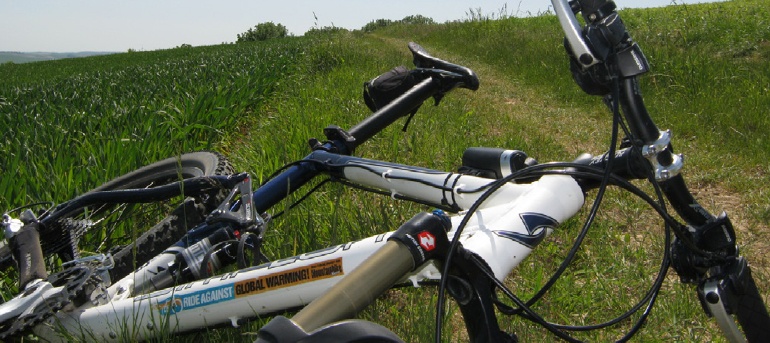
Mountain bike tour Starting from Ernstbrunn, Main Square by the Landsknecht Fountain
Circumnavigation of the municipal area of the market town of Ernstbrunn on field, forest and road paths Surface: 10% asphalt, 90% field paths, farm tracks, forest roads and trails
Circumnavigation of the municipal area of the market town of Ernstbrunn on field, forest and road paths Surface: 10% asphalt, 90% field paths, farm tracks, forest roads and trails
Places of interest along the way :
- Very beautiful views and insights into the municipality of Ernstbrunn
From the main square, cycle north along the road toward Klement—the climb up to the “quarry” is just right for warming up—about 300 m past the factory exit, turn right onto the dirt road – The border loop begins at the windbreak – heading east, the route immediately descends briskly toward Nodendorf – Cross the federal highway – turn right over the bridge – follow the dirt road to the Taschelbach stream and follow it – now take a sharp left up the steep climb to the Windberg – then keep right and follow the dirt road back to the highway – turn right and cross the railroad tracks – Take Federal Highway 40 toward Mistelbach – turn right before the bridge (7.4 km) and cross the Taschelbach – ride up to the windbreak – descend to the Gebmannsbach,
, then cross the bridge heading south – ride up to the Gebmannsberg along the dirt roads – now head west toward the federal highway – in the long “Weissberg Curve,” exit the highway at 13.2 km and head south toward Grillenberg – continue south to the wooded area, which you’ll bypass on the east side – descend to the road and turn left toward Wetzleinsdorf – at the town entrance, turn right and continue west – follow the edge of the forest to the road and turn right toward Lachsfeld – after about 1 km, turn left onto the dirt road – follow it, keep slightly to the right, and climb up to the road (20.9 km) – Pass the village of Lachsfeld on your right – continue west toward Grünstatt, but circle around it on the right before reaching it – climb up to Dornberg – quick descent west to the Senningbach – Follow the path to Maisbirbaum – Continue on dirt roads through hilly terrain to Nursch and then on the road to Merkersdorf – At the church, leave the village heading north and reach the road via dirt roads – Now turn left toward the “Scheibenwiese” intersection – follow the road to the right; at the forest exit, turn left onto the forest road and follow the “Blauburger Radweg” to Röhrabrunn – at the Zayabach (51.3 km), turn left over the bridge eastward up to the federal highway – After crossing, continue along dirt roads to Pyhra – ride through Pyhra and follow the road to Klement – at the edge of town, turn left into the residential area and, at the end of town, turn left uphill to the hiking trail on the ridge – now turn left and follow the “632er” hiking trail to the second signpost (59.8 km) – now turn right onto the Römerweg and descend steeply into the village of “Au” – after passing through the village, climb the Oberleiser Berg via dirt roads – at the edge of the forest, turn right to the end of the dirt road – at the paved road, turn left and ride steeply uphill to the lookout tower – after circling it, take the footpath down to the old estate – at the large parking lot, turn left and head down to the fish pond – then turn left and follow the dirt paths to the white wayside shrine (64.6 km) – now comes the final downhill (Watch out for roots!!!) back to the starting point at the windbreak – You made it! Ride back across the road to Ernstbrunn’s main square.
Leider können wir Ihnen zum jetzigen Zeitpunkt keine Wetterdaten für den Ort anzeigen.